Defense Detainment & Hard Kill Systems
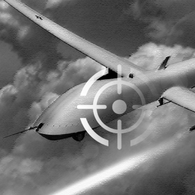
INTERCEPTION
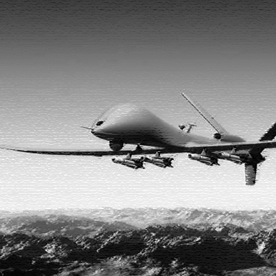
UAV/DRONE

UAV/DRONES
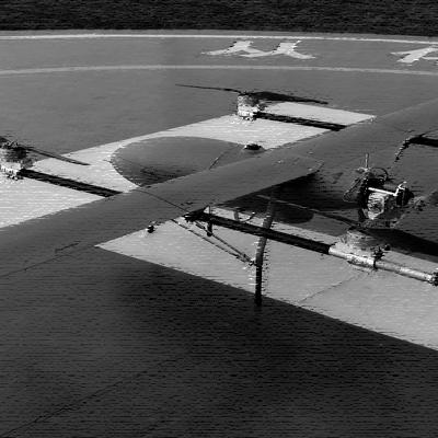
MEGA-SHARK HYBRID VTOL(BTO)
Endurance: >5 Hrs (Hybrid), <3Hrs (Motor)
Speed: Cruising 100Km/Hr, Max 120Km/Hr
Wing Span: 4400mm
Payload: 3 to 10Kg
Range: 100Km to 150Km


FIREFLY (FF) (BTO)
A big UAS VTOL (Vertical Take-Off and Landing).
Endurance: 2 Hrs (Motor)
Speed: Cruising 86Km/Hr, Max 120Km/Hr
Wing Span: 3500mm
Payload; 7.8Kg
Range: Up to 100Km
MUG-V5000 VTOL (DRAGON SERIES)
The MUG-V5000 is an exceptionally large aircraft designed for professional use.
Wingspan: 5000mm
Length: 3500mm
Maximum Payload: 20kg
Volume of Fuel Tank: 28Liters
Endurance: up to 8 Hours


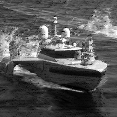
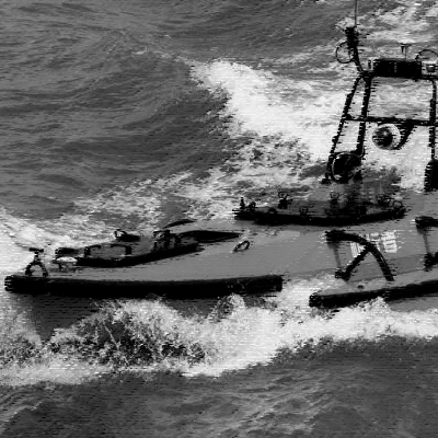
Autonomous Surveillance & Rescue Vessel
M75 is specified to apply in security, patrol, Search & rescue, investigation and evidence collection areas. With high speed propulsion system, M75 could arrive target place at the first moment.

RC Rescue LifeBuoy
The leading unmanned surface rescue vehicle (USRV) for public safety, lifeguards, marinas, offshore oil and gas platforms, and ships. The Smart LifeBuoy bright color and flash lights make it eminently noticeable in water and reduce the risk of the rescuer losing sight of the victim.


RC Rescue Lifebuoy D3+
The Lifebuoy D3 and D3+ is an advanced, compact, and robust remote-controlled lifebuoy designed for swift and efficient water rescues.
It features a high-speed propulsion system, enabling rapid deployment to distressed individuals, even in rough waters.

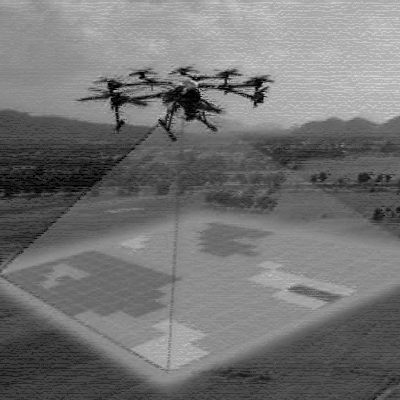
DRONES & VTOLs USAGES
Drones and Vertical Take-Off and Landing (VTOL) UAVs (Unmanned Aerial Vehicles) have become essential tools in various industries due to their versatility, efficiency, and ability to access hard-to-reach areas. Here's an overview of the services provided by these technologies:
1. Surveillance and Security
Border Security: Drones equipped with high-resolution cameras, thermal imaging, and sensors are used to monitor borders, coastline surveillance, and detect illegal activities like smuggling.
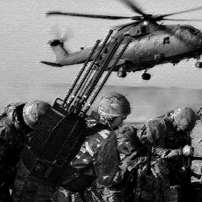
Military Operations: VTOL UAVs play a critical role in reconnaissance, intelligence gathering, and target tracking in defense and military missions. They can hover and take off from almost any location, making them suitable for rapid deployment.
Private Security: For businesses, large estates, or sensitive sites, drones provide 24/7 aerial surveillance, ensuring security and minimizing risks of intrusions.
2. Mapping and Surveying
Land and Asset Surveys: Drones are widely used for topographic mapping, 3D modeling, and land surveying, which are crucial in industries like construction, mining, and infrastructure development. VTOL UAVs are especially useful for large or difficult terrains.
Agricultural Monitoring: Drones equipped with multispectral sensors help monitor crop health, assess soil conditions, and improve precision farming by providing critical data on irrigation needs or pest infestations.
Environmental Monitoring: Drones monitor ecosystems, wildlife, and deforestation, while UAVs can inspect areas after natural disasters, aiding rescue operations or environmental assessment.
3. Logistics and Delivery
Medical and Emergency Supplies: VTOL UAVs are increasingly being used to deliver medical supplies, vaccines, and even organs to remote or disaster-stricken areas where ground transportation is not feasible.
Commercial Deliveries: Several companies are exploring drone-based delivery systems for e-commerce, allowing for faster and more efficient deliveries, particularly in urban areas.
4. Aerial Photography and Cinematography
Drones are used extensively in capturing high-quality images and video footage for movies, commercials, real estate, and tourism. Their ability to fly at low altitudes and capture unique angles makes them highly valued in the media industry.
5. Infrastructure Inspection
Utility and Power Lines: Drones equipped with sensors and cameras are used to inspect power lines, wind turbines, oil and gas pipelines, and telecommunications towers. This service reduces the risk of human injury and provides detailed data on structural integrity.
Bridge and Building Inspection: VTOL UAVs can perform inspections in areas that are hard to access by conventional methods, identifying potential problems in infrastructure and reducing the time and costs associated with manual inspections.
6. Search and Rescue Operations
Drones equipped with infrared cameras and advanced sensors are essential in search and rescue operations. Their ability to cover large areas quickly and provide real-time data makes them invaluable for locating missing persons or survivors during natural disasters or accidents.
7. Disaster Management
Drones are widely used to assess damage after earthquakes, floods, or fires, providing real-time data to aid first responders and recovery teams. They can help map affected areas, guide evacuation plans, and deliver essential supplies to cut-off regions.
8. Agriculture and Forestry
Crop Spraying: Drones and VTOL UAVs can apply pesticides, fertilizers, or water over large areas, offering precision farming solutions that reduce waste and increase yields.
Forest Management: Drones monitor deforestation, track forest fires, and assess reforestation projects. UAVs can collect data on tree health, species composition, and forest density.
9. Law Enforcement
Drones assist police in monitoring large public events, crowd control, tracking suspects, and ensuring public safety. VTOL UAVs offer a tactical advantage by providing aerial surveillance in difficult-to-navigate urban environments.
10. Oil, Gas, and Energy
Drones inspect oil rigs, refineries, and pipelines for potential issues, enabling companies to conduct maintenance and safety checks more efficiently and reduce downtime. VTOL UAVs can reach remote offshore platforms or distant pipeline networks, making them ideal for this industry.
Conclusion
The use of drones and VTOL UAVs across industries is rapidly growing due to their adaptability, cost-effectiveness, and ability to provide data in real time. From surveillance to logistics, they enhance operational efficiency and minimize human risk, making them indispensable for many modern applications.
If you are considering utilizing drone services for your business or operation, there are many customizable solutions available, depending on your specific needs and the environment in which they will be deployed.
QUAD COPTER DRONE
DLD-15
Air drome launcher with multi-magazine non-lethal ammunition dropping system.